It has taken me almost 6 months to make peace with this image and process it. Of course, a little backstory is required after a statement like that.
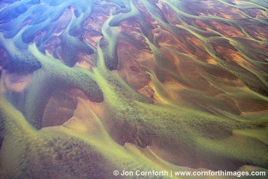
When I started building and flying my own drones last year, I was motivated to photograph interesting aerial abstracts during my travels without having to hire an airplane. I scoured Google Earth for interesting topography and then set out to photograph it. One of the locations where I envisioned flying my hexacopter to produce an image was above the mudflats where the Nooksack River flowed into Bellingham Bay. The satellite views showed an intricate network of braided channels that I thought looked like a painting.
So, back to the difficult part about processing this image. On my second attempt to fly over this landscape, I had secured a permit from the Lummi tribe to walk out on the mudflats. My dad joined me on a gorgeous day in May with ideal flying conditions. I was feeling confident and flew my drone farther and higher than I had ever flown before (roughly 600m out and 100m up) to compose this image. On my second flight of the day, my hexacopter unfortunately experienced a sudden and rapid descent into the terrain below. Ouch. I could see that my hexacopter was sticking out of the water, so after a lot of effort to reach it I recovered it. The submersion damaged most of the electronics and flooded my camera, but at least the memory card was recoverable and the SuperX flight controller is waterproof. Upon reviewing the blackbox data, I discovered that the reason for the crash was a loss of power to one of my motors which upon inspection showed a poor solder connection which I blame on the Chinese manufacturer. I hope that you agree that this is an exciting application of technology used to produce a beautiful image.
