Kiholo Bay Aerial 1 & Drone Photography
Posted onIn the last 6 months, I have spent a lot of time reconsidering my overall photography ambitions while also healing my back injury. It has not been my most productive 6 months, but I have also been doing this full-time for 13 years now, so I can live with a little bit of ebb and flow to my ambitions. During this downtime, I have invested way too much time and money learning to build and fly remote controlled hexacopters. Call it a drone if you must, but I find this word leads to negative connotations due to the media’s overemphasis on scaring people. I find the new technology fascinating and am excited to explore an entirely new world of possibilities creating images that no one has ever seen before.
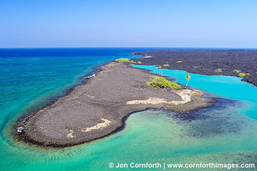
This is a recent aerial photo that I created of Kiholo Bay located on the Kohala Coast of the Big Island of Hawaii. I have previously visited this location to create a traditional landscape photo using a tripod, but been unsuccessful. The biggest limitation has been that it just doesn’t look that interesting from shore. So, I decided to explore this beautiful bay from the air. The photo that I envisioned was to show the beautiful turquoise color of the water and the coral reef surrounding the lava island.
My hexacopter is only capable of flying my camera for about 15 minutes at a time, so I used my early flights to scout for a composition. I did this by using the first person view (fpv) offered by using my camera’s Live View and video transmission system which sends the signal down to my remote monitor. Eventually, I determined that I needed to hover in this location about 20m up in the air. I found the color of the water mesmerizing and the shape of the lava island compelling. When I zoom in at 100% resolution, I can also see several sea turtles resting along the shoreline.